This Digitip explains how to access the flyover feature in Apple Maps. In addition it looks at using maps as a replacement for Google Earth.
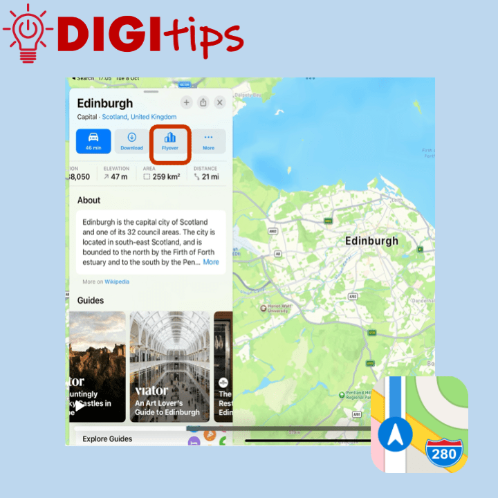
Apple Maps has a feature called flyover, this allows the user to see a ‘drone type‘ view of special landmarks in a city. The cities that have flyovers can be found here: https://www.apple.com/ios/feature-availability/#maps-flyover
It is possible to enter into the flyover and pause the video and then navigate to landmarks and buildings throughout a city that are featured.
Learners and teachers could screen record the flyover and export to either iMovie or Keynote to add their own voice over. You could compare and contrast similar features of different cities.
This links with the following areas in the curriculum of excellence: SOC 21-14a, SOC 2-14a & SOC 3-14a